

Jeanne Newby
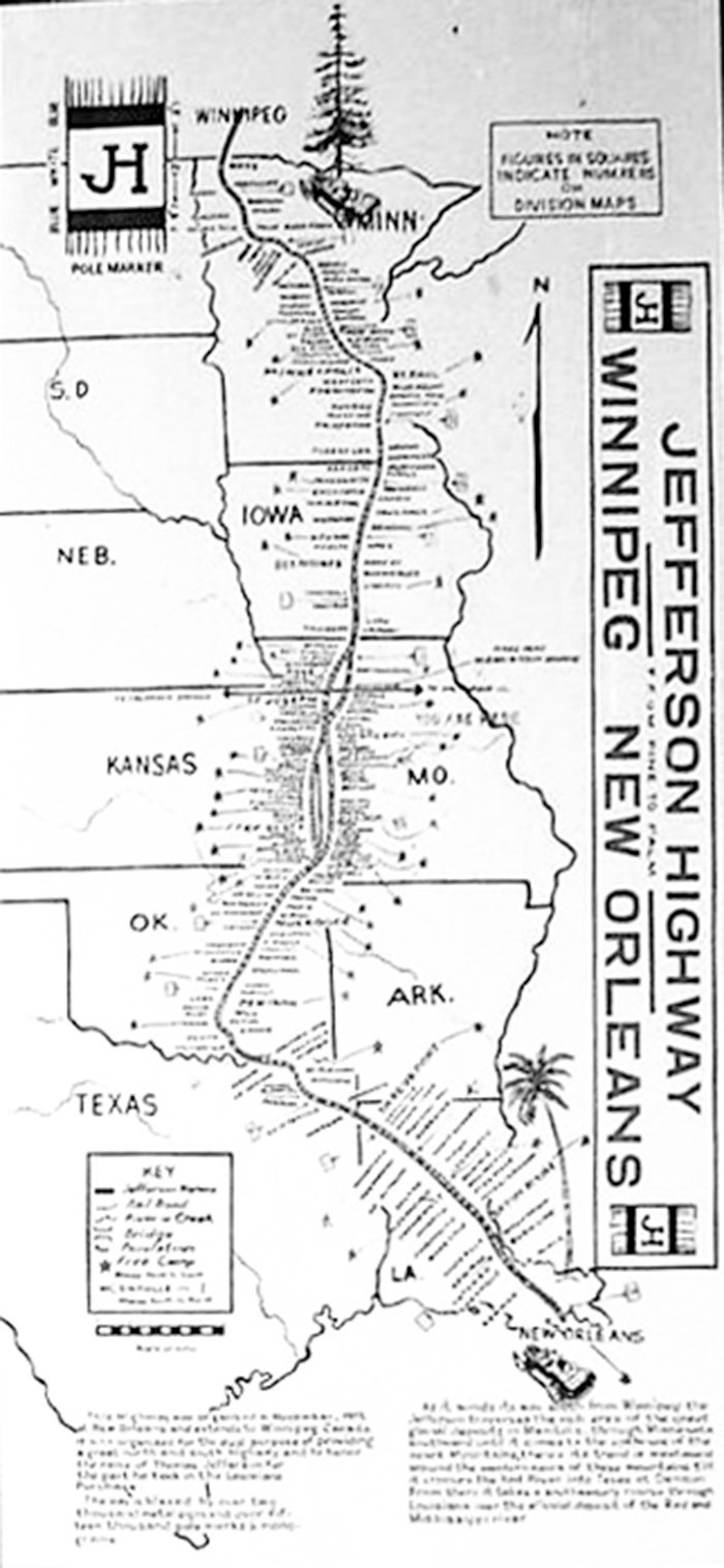
The Jefferson Highway was a north-to-south route extending 2,300 miles from Winnipeg, Canada, to New Orleans, La. The symbols were a Pine Tree and a Palm Tree, referring to the trees along the route. Many called the highway “The Vacation Route of America,” and it came right through our town of Webb City.
Originally it came into Webb City from Carterville on Daugherty Street to Devon Street, and jogged south one block to Broadway. It turned south again on Main Street. At Fourth Street, Jefferson Highway turned west, continuing to Madison Street. (This was before MacArthur Boulevard, or Highway 171 was built. It must also be noted that Broadway was called Main Street and Joplin Street then, and Main Street was Allen Street.)
Madison, back then, was being worked on to transition it from streetcars to automobiles and trucks. The highway continued south on Madison to Joplin.
That route was short-lived, replaced by a different route meant to allow travelers to see more of Webb City.
The new route stayed on Daugherty Street until it got to Main Street. This allowed tourists to see Merchants & Miners Bank and other Main Street businesses on the block between Daugherty and Broadway.
Instead of going to Fourth Street, the new route went west on Broadway, passing the Coney Island restaurant at Broadway and Main.
Then there was that little jog on Webb Street, immediately turning right onto Broadway. The traveler was able to enjoy the beautiful sights of E.T. Webb’s mansion, the Methodist Church, the O’Neill home, the Presbyterian Church and the Baptist Church before turning south on Oronogo Street.
Then the route turned west onto Fourth Street, passing by the former Eugene Field School. As before, the highway turned south on Madison Street to the new concrete portion of the street that started at 13th Street and extended to Zora Street, and then through Royal Heights to Broadway in Joplin.
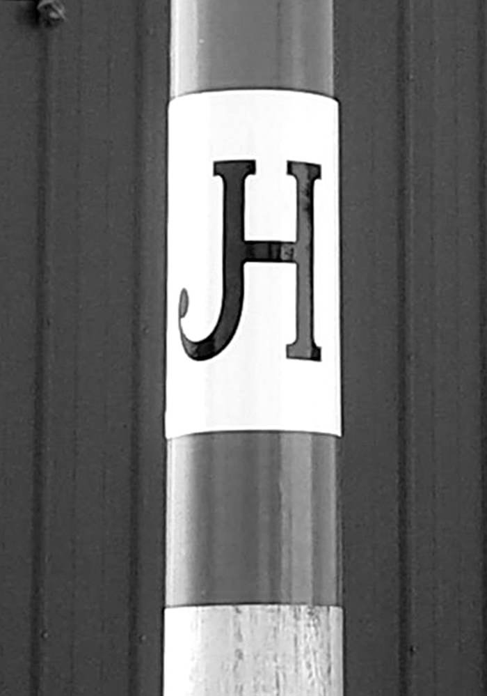
The signs marking the route along the Jefferson Highway were always attached to poles. They were square, with a blue band across the top and bottom, a 12-inch white band and the initials JH in the middle. Most of those signs were scrapped during the war. Some signs were painted directly on the poles. When possible, there were two signs at an intersection. One indicated where to turn, and the other verified the correct turn had been made.
According to a newspaper article, the “Missouri Highway gang” was in Webb City putting up directional signs to help tourists follow the Jefferson Highway through town. The highway had been in town for six years, so they must have been updating the signs.
The Jefferson Highway was in existence until 1929, when the highways bearing numbers began taking over. Route 66 replaced it in Webb City.
The Jefferson Highway celebrated its 100th anniversary in 2015. It would be great to have the Jefferson Highway signs marking the route. Carthage, Carterville, Webb City and Joplin all had the distinction of having both the north-south Jefferson Highway and the east-west Route 66 both passing through their towns and their history. Other Missouri towns, such as Kansas City, Nevada, Jasper, Lamar and Neosho, had the Jefferson Highway passing through them, but they did not have Route 66, which makes us in Jasper County unique.
Popularity in the Jefferson Highway is booming. You can find the Jefferson Highway Association on Facebook, with pictures and history. Jump on board the campaign trail to get Jefferson Highway marked through Webb City. It was an important piece of our history!

We use cookies to improve your experience on our site. By using our site, you consent to cookies.
Manage your cookie preferences below:
Essential cookies enable basic functions and are necessary for the proper function of the website.
Statistics cookies collect information anonymously. This information helps us understand how visitors use our website.
Google Analytics is a powerful tool that tracks and analyzes website traffic for informed marketing decisions.
Service URL: policies.google.com (opens in a new window)